
Thank you for supporting this site ❤️
Make a donation
Make a donation
Gear up for your next adventure:
As an Amazon Associate, this site earns from qualifying purchases at no extra cost to you.
昭林 topographic map
Click on the map to display elevation.
Thank you for supporting this site ❤️
Make a donation
Make a donation
Gear up for your next adventure:
As an Amazon Associate, this site earns from qualifying purchases at no extra cost to you.
About this map
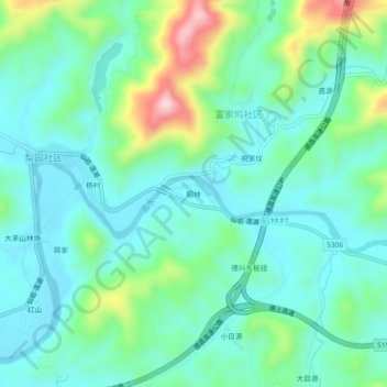
Name: 昭林 topographic map, elevation, terrain.
Location: 昭林, 富家坞社区, Dexing, Shangrao, Jiangxi, China (28.93758 117.74291 28.97758 117.78291)
Average elevation: 145 m
Minimum elevation: 71 m
Maximum elevation: 375 m
Thank you for supporting this site ❤️
Make a donation
Make a donation
Gear up for your next adventure:
As an Amazon Associate, this site earns from qualifying purchases at no extra cost to you.