Geolocate

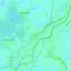
Telacsan topographic map

Click on the map to display elevation.

About this map

Name: Telacsan topographic map, elevation, terrain.

Location: Telacsan, Macabebe, Pampanga, Central Luzon, 2018, Philippines (14.93545 120.71844 14.94605 120.73109)

Average elevation: 3 m

Minimum elevation: -1 m

Maximum elevation: 5 m

Other topographic maps

Click on a map to view its topography, its elevation and its terrain.

Batasan

Philippines > Pampanga > Macabebe

Average elevation: 3 m

San Francisco

Philippines > Pampanga > Macabebe

Average elevation: 3 m

Santa Rita

Philippines > Pampanga > Macabebe

Average elevation: 3 m

San Roque

Philippines > Pampanga > Macabebe

Average elevation: 2 m

Batasan

Philippines > Pampanga > Macabebe

Average elevation: 3 m

Gear up for your next adventure:

🧢Hiking Hats - Sun and weather protection for outdoor walks
🍱Food Containers - Reusable containers for outdoor meals
📸Action Camera Chest Mounts - Record your ascent following topographic paths hands-free
📦Compression Sacks - Reduce backpack volume efficiently
🕶️Glacier Goggles - Maximum protection for high-altitude snow topography

As an Amazon Associate, this site earns from qualifying purchases at no extra cost to you.