Geolocate

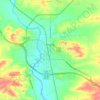
Clayton topographic map

Click on the map to display elevation.

About this map

Name: Clayton topographic map, elevation, terrain.

Location: Clayton, Converse County, Wyoming, United States (42.83386 -105.77167 42.87386 -105.73167)

Average elevation: 1,529 m

Minimum elevation: 1,496 m

Maximum elevation: 1,577 m

Other topographic maps

Click on a map to view its topography, its elevation and its terrain.
Glenrock

United States > Wyoming > Converse County

Average elevation: 1,546 m

Douglas

United States > Wyoming > Converse County

Average elevation: 1,492 m

Douglas

United States > Wyoming > Converse County

Average elevation: 1,492 m

Gear up for your next adventure:

🧭Emergency Beacons - Safety beacons for remote outdoor locations
🚲Bikepacking Frame Bags - Storage for tools and navigation gear on long off-road rides
🧊Personal Water Filters - Drink safely from mountain streams marked on your map
🔥Reusable Hand Warmers - Maintain dexterity in your fingers for precise map handling
🚶Walking Pedometers - Simple distance tracking for casual trail walkers

As an Amazon Associate, this site earns from qualifying purchases at no extra cost to you.