Geolocate

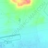
Al Qastal topographic map

Click on the map to display elevation.

About this map

Name: Al Qastal topographic map, elevation, terrain.

Location: Al Qastal, Jizah Sub-District, Jizah District, Amman, 11104, Jordan (31.73000 35.91333 31.77000 35.95333)

Average elevation: 740 m

Minimum elevation: 708 m

Maximum elevation: 775 m

Other topographic maps

Click on a map to view its topography, its elevation and its terrain.
Qasr Mshatta

Jordan > Amman > Jizah Sub-District

Average elevation: 739 m

Gear up for your next adventure:

👟Heavy Duty Boot Laces - Always carry a spare for your hiking footwear
🔋Power Banks - Portable chargers for long outdoor trips
📱Rugged Phone Cases - Heavy-duty protection for smartphones used as secondary GPS tools
📕Outdoor Navigation Books - Learn traditional and modern navigation techniques
📷Camera Straps - Secure straps for carrying cameras while walking

As an Amazon Associate, this site earns from qualifying purchases at no extra cost to you.