
Thank you for supporting this site ❤️
Make a donation
Make a donation
Gear up for your next adventure:
As an Amazon Associate, this site earns from qualifying purchases at no extra cost to you.
Sauki topographic map
Click on the map to display elevation.
Thank you for supporting this site ❤️
Make a donation
Make a donation
Gear up for your next adventure:
As an Amazon Associate, this site earns from qualifying purchases at no extra cost to you.
About this map
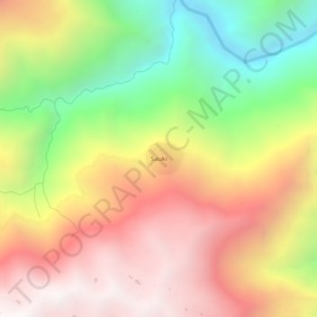
Name: Sauki topographic map, elevation, terrain.
Location: Sauki, Yanatile, Calca, Cusco, Perú (-12.95048 -71.92775 -12.91048 -71.88775)
Average elevation: 2,961 m
Minimum elevation: 2,038 m
Maximum elevation: 3,791 m
Thank you for supporting this site ❤️
Make a donation
Make a donation
Gear up for your next adventure:
As an Amazon Associate, this site earns from qualifying purchases at no extra cost to you.