
Cumhuriyet topographic map
Interactive map
Click on the map to display elevation.
About this map
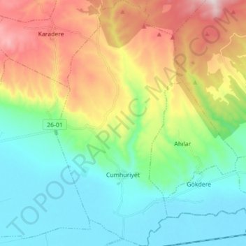
Name: Cumhuriyet topographic map, elevation, terrain.
Location: Cumhuriyet, Tepebaşı, Eskişehir, İç Anadolu Bölgesi, Turquía (39.79949 30.60478 39.90611 30.67690)
Average elevation: 1,011 m
Minimum elevation: 774 m
Maximum elevation: 1,485 m