Geolocate

Sitapur topographic map

Click on the map to display elevation.

About this map

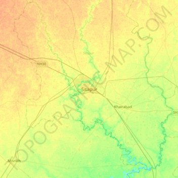
Name: Sitapur topographic map, elevation, terrain.

Location: Sitapur, Uttar Pradesh, 261001, India (27.40156 80.52401 27.72156 80.84401)

Average elevation: 138 m

Minimum elevation: 123 m

Maximum elevation: 147 m

Gear up for your next adventure:

👕Technical Hiking Tees - Moisture-management for high-exertion climbs
🥾Trekking Poles - Poles to improve stability on uneven terrain
🧣Neck Gaiters - Versatile protection against wind and cold
🧰Survival Kits - Emergency tools for remote environments
🧤Hiking Gloves - Warm and durable gloves for cold-weather walks

As an Amazon Associate, this site earns from qualifying purchases at no extra cost to you.