Geolocate

Sell topographic map

Interactive map

Click on the map to display elevation.

About this map

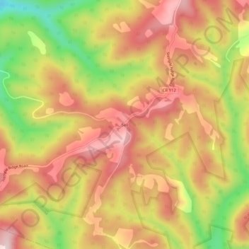
Name: Sell topographic map, elevation, terrain.

Location: Sell, Preston County, West Virginia, United States (39.24510 -79.60672 39.28510 -79.56672)

Average elevation: 743 m

Minimum elevation: 524 m

Maximum elevation: 894 m

Other topographic maps

Click on a map to view its topography, its elevation and its terrain.

Jessop

United States > West Virginia > Preston County

Average elevation: 616 m

Victoria

United States > West Virginia > Preston County

Average elevation: 474 m

Newburg

United States > West Virginia > Preston County

Average elevation: 451 m

Preston

United States > West Virginia > Preston County > Preston

Average elevation: 502 m

Kingwood

United States > West Virginia > Preston County

Average elevation: 530 m