
Harrisonville topographic map
Interactive map
Click on the map to display elevation.
About this map
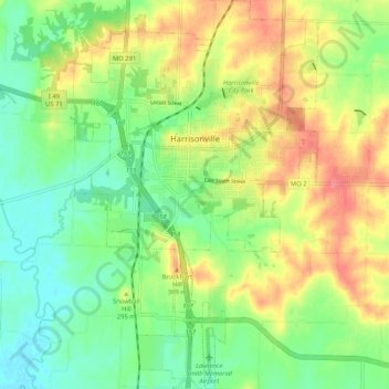
Name: Harrisonville topographic map, elevation, terrain.
Location: Harrisonville, Cass County, Missouri, United States (38.60283 -94.37974 38.68394 -94.31416)
Average elevation: 283 m
Minimum elevation: 252 m
Maximum elevation: 324 m
Other topographic maps
Click on a map to view its topography, its elevation and its terrain.