
Enrekang topographic map
Interactive map
Click on the map to display elevation.
About this map
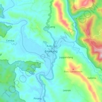
Name: Enrekang topographic map, elevation, terrain.
Location: Enrekang, Luwu Utara, Sulsel, 91711, Indonésia (-3.60572 119.73241 -3.52572 119.81241)
Average elevation: 178 m
Minimum elevation: 39 m
Maximum elevation: 680 m