
Anchalay topographic map
Interactive map
Click on the map to display elevation.
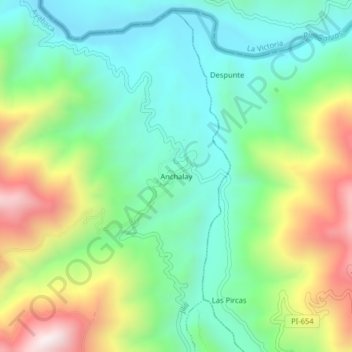
Anchalay topographic map, elevation, terrain
About this map
Name: Anchalay topographic map, elevation, terrain.
Location: Anchalay, Jililí, Provincia de Ayabaca, Piura, Perú (-4.52759 -79.82122 -4.48759 -79.78122)
Average elevation: 843 m
Minimum elevation: 549 m
Maximum elevation: 1,422 m