
Gänsruh topographic map
Interactive map
Click on the map to display elevation.
About this map
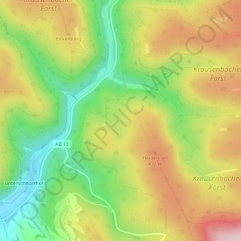
Name: Gänsruh topographic map, elevation, terrain.
Average elevation: 363 m
Minimum elevation: 227 m
Maximum elevation: 510 m
Other topographic maps
Click on a map to view its topography, its elevation and its terrain.
Oberwintersbach (Geishöhe)
Deutschland > Bayern > Landkreis Aschaffenburg > Dammbach
Oberwintersbach (Geishöhe), Wintersbach, Dammbach, Mespelbrunn (VGem), Landkreis Aschaffenburg, Bayern, 63874, Deutschland
Average elevation: 398 m