
Wiluna topographic map
Interactive map
Click on the map to display elevation.
About this map
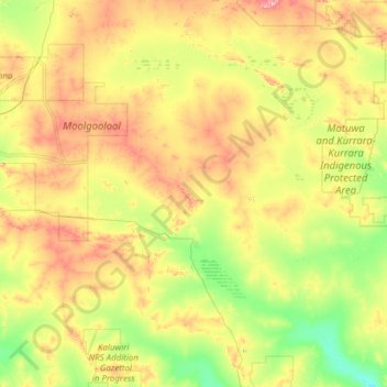
Name: Wiluna topographic map, elevation, terrain.
Location: Wiluna, Shire Of Wiluna, Western Australia, Australia (-27.29235 119.19684 -25.37666 121.64897)
Average elevation: 553 m
Minimum elevation: 466 m
Maximum elevation: 807 m
Other topographic maps
Click on a map to view its topography, its elevation and its terrain.
Mount Keith
Australia > Western Australia > Wiluna
Mount Keith, Wiluna, Shire Of Wiluna, Western Australia, Australia
Average elevation: 572 m