
Calver Sough topographic map
Interactive map
Click on the map to display elevation.
About this map
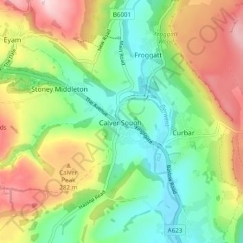
Name: Calver Sough topographic map, elevation, terrain.
Average elevation: 218 m
Minimum elevation: 112 m
Maximum elevation: 378 m
Other topographic maps
Click on a map to view its topography, its elevation and its terrain.
Stoke Brook
United Kingdom > England > Derbyshire > Derbyshire Dales > Calver Sough
Stoke Brook, Calver CP, Calver Sough, Derbyshire Dales, Derbyshire, East Midlands, England, S32 3ZD, United Kingdom
Average elevation: 197 m
Curbar Edge
United Kingdom > England > Derbyshire > Derbyshire Dales > Calver Sough
Curbar Edge, Baslow and Bubnell CP, Calver Sough, Derbyshire Dales, Derbyshire, England, S32 3YR, United Kingdom
Average elevation: 251 m