Geolocate

Thorner topographic map

Click on the map to display elevation.

About this map

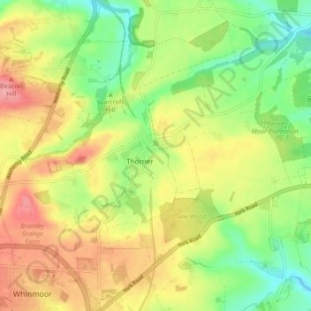
Name: Thorner topographic map, elevation, terrain.

Location: Thorner, Leeds, West Yorkshire, England, United Kingdom (53.84302 -1.47380 53.87228 -1.39166)

Average elevation: 98 m

Minimum elevation: 52 m

Maximum elevation: 148 m

England trails, hiking, mountain biking, running and outdoor activities

Gear up for your next adventure:

🔋Rechargeable Batteries - Eco-friendly power for headlamps and older GPS units
Altimeter Watches - Watches measuring altitude for mountain activities
📷Outdoor Action Cameras - Cameras designed for hiking and adventure
📍Handheld GPS Navigators - Reliable satellite navigation for hiking and off-road exploration
🦟Anti-Midge & Tick Repellent - Vital for hiking in the Scottish Highlands during summer

As an Amazon Associate, this site earns from qualifying purchases at no extra cost to you.