
San Augustine County topographic map
Interactive map
Click on the map to display elevation.
About this map
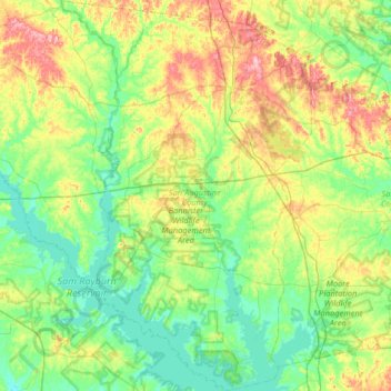
Name: San Augustine County topographic map, elevation, terrain.
Location: San Augustine County, Texas, United States (31.09930 -94.39882 31.65361 -93.98324)
Average elevation: 81 m
Minimum elevation: 42 m
Maximum elevation: 179 m
Other topographic maps
Click on a map to view its topography, its elevation and its terrain.
Broaddus
United States > Texas > San Augustine County
Broaddus, San Augustine County, Texas, United States
Average elevation: 73 m