
Cardwell Mountain topographic map
Interactive map
Click on the map to display elevation.
About this map
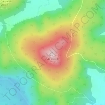
Name: Cardwell Mountain topographic map, elevation, terrain.
Average elevation: 386 m
Minimum elevation: 263 m
Maximum elevation: 571 m
Other topographic maps
Click on a map to view its topography, its elevation and its terrain.
McMinnville
United States > Tennessee > Warren County
McMinnville, Warren County, Middle Tennessee, Tennessee, 37110, United States
Average elevation: 302 m