
Daykundi Province topographic map
Interactive map
Click on the map to display elevation.
About this map
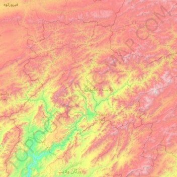
Name: Daykundi Province topographic map, elevation, terrain.
Location: Daykundi Province, Afghanistan (32.92605 65.22750 34.36933 67.41922)
Average elevation: 2,616 m
Minimum elevation: 1,072 m
Maximum elevation: 4,747 m
Other topographic maps
Click on a map to view its topography, its elevation and its terrain.
Penman
Afghanistan > Daykundi Province
Penman, Kiti, Daykundi Province, Afghanistan
Average elevation: 1,557 m