Geolocate

La Ribera topographic map

Click on the map to display elevation.

About this map

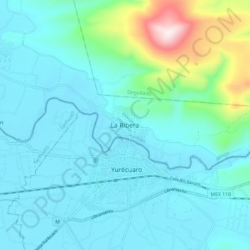
Name: La Ribera topographic map, elevation, terrain.

Location: La Ribera, Ayotlán, Jalisco, 59250, Mexico (20.30947 -102.32261 20.38947 -102.24261)

Average elevation: 1,631 m

Minimum elevation: 1,527 m

Maximum elevation: 2,191 m

Gear up for your next adventure:

Insulated Travel Mugs - Keep drinks hot while surveying the landscape from a summit
🔋Power Banks - Portable chargers for long outdoor trips
🔭Compact Hiking Binoculars - Lightweight optics for scouting terrain and spotting wildlife
🥤Hydration Bladders - Hands-free hydration systems for backpacks
🔥Reusable Hand Warmers - Maintain dexterity in your fingers for precise map handling

As an Amazon Associate, this site earns from qualifying purchases at no extra cost to you.