
French Creek State Park topographic map
Interactive map
Click on the map to display elevation.
About this map
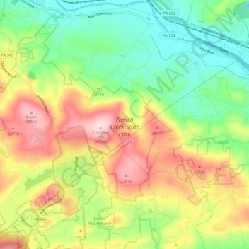
Name: French Creek State Park topographic map, elevation, terrain.
Average elevation: 148 m
Minimum elevation: 30 m
Maximum elevation: 309 m
Other topographic maps
Click on a map to view its topography, its elevation and its terrain.
Warwick
United States > Pennsylvania > Chester County > Warwick Township
Warwick, Warwick Township, Chester County, Pennsylvania, 19520, United States
Average elevation: 185 m