
Ksar El Abtal topographic map
Interactive map
Click on the map to display elevation.
About this map
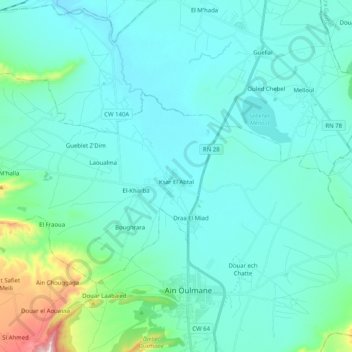
Name: Ksar El Abtal topographic map, elevation, terrain.
Location: Ksar El Abtal, Ain Oulmane District, Setif, Algeria (35.92658 5.11343 36.02570 5.31578)
Average elevation: 949 m
Minimum elevation: 878 m
Maximum elevation: 1,424 m