
Pendra Road Gorella Tahsil topographic map
Interactive map
Click on the map to display elevation.
About this map
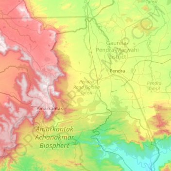
Name: Pendra Road Gorella Tahsil topographic map, elevation, terrain.
Location: Pendra Road Gorella Tahsil, Bilaspur, Chhattisgarh, Indien (22.54645 81.72717 22.91973 82.23647)
Average elevation: 658 m
Minimum elevation: 335 m
Maximum elevation: 1,133 m
Other topographic maps
Click on a map to view its topography, its elevation and its terrain.