
Riverside topographic map
Interactive map
Click on the map to display elevation.
About this map
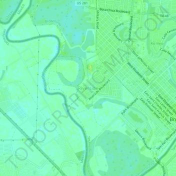
Name: Riverside topographic map, elevation, terrain.
Location: Riverside, Cameron County, Texas, 78520, USA (25.88869 -97.54248 25.92869 -97.50248)
Average elevation: 12 m
Minimum elevation: 7 m
Maximum elevation: 18 m