
Bad König topographic map
Interactive map
Click on the map to display elevation.
About this map
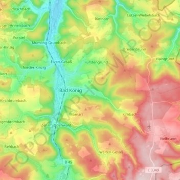
Name: Bad König topographic map, elevation, terrain.
Location: Bad König, Odenwaldkreis, Hesse, 64732, Germany (49.70258 8.91540 49.78067 9.08474)
Average elevation: 311 m
Minimum elevation: 156 m
Maximum elevation: 497 m