
Agualva-Cacém topographic map
Interactive map
Click on the map to display elevation.
About this map
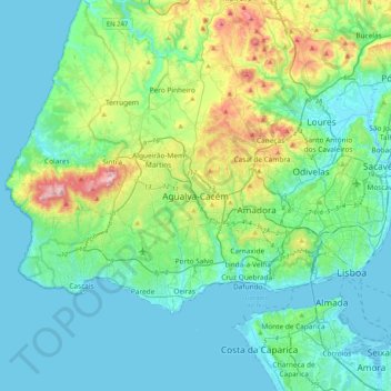
Name: Agualva-Cacém topographic map, elevation, terrain.
Location: Agualva-Cacém, Sintra, Lisbon, 2735-229, Portugal (38.61029 -9.46069 38.93029 -9.14069)
Average elevation: 96 m
Minimum elevation: -2 m
Maximum elevation: 499 m
Other topographic maps
Click on a map to view its topography, its elevation and its terrain.