
Ngamprah topographic map
Interactive map
Click on the map to display elevation.
About this map
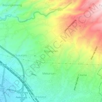
Name: Ngamprah topographic map, elevation, terrain.
Location: Ngamprah, Bandung Barat, West Java, Java, 40511, Indonesia (-6.85767 107.49650 -6.81767 107.53650)
Average elevation: 823 m
Minimum elevation: 663 m
Maximum elevation: 1,102 m
Other topographic maps
Click on a map to view its topography, its elevation and its terrain.