
Stuben topographic map
Interactive map
Click on the map to display elevation.
About this map
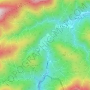
Name: Stuben topographic map, elevation, terrain.
Location: Stuben, Landkreis Miesbach, Upper Bavaria, Bavaria, Germany (47.60288 11.63466 47.60442 11.63571)
Average elevation: 1,049 m
Minimum elevation: 878 m
Maximum elevation: 1,336 m