
Kawan topographic map
Interactive map
Click on the map to display elevation.
About this map
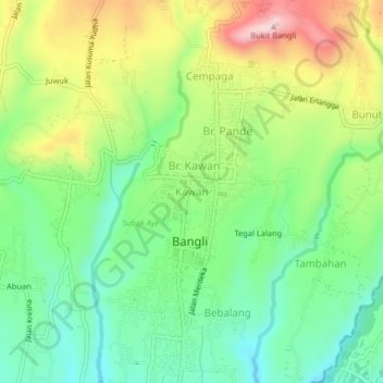
Name: Kawan topographic map, elevation, terrain.
Location: Kawan, Bangli, Bali, Lesser Sunda Islands, 80613, Indonesia (-8.47517 115.33371 -8.43517 115.37371)
Average elevation: 419 m
Minimum elevation: 310 m
Maximum elevation: 594 m
Other topographic maps
Click on a map to view its topography, its elevation and its terrain.