
Tākaka topographic map
Interactive map
Click on the map to display elevation.
About this map
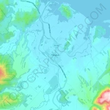
Name: Tākaka topographic map, elevation, terrain.
Location: Tākaka, Tasman, 7110, New Zealand (-40.89750 172.76624 -40.81750 172.84624)
Average elevation: 50 m
Minimum elevation: 0 m
Maximum elevation: 531 m
Other topographic maps
Click on a map to view its topography, its elevation and its terrain.
Dragons Teeth
New Zealand > Tasman > Tasman District
Dragons Teeth, Tasman District, Tasman, New Zealand
Average elevation: 1,214 m
Saint Arnaud
New Zealand > Tasman > Saint Arnaud
Saint Arnaud, Tasman, 7053, New Zealand
Average elevation: 701 m
Wakefield
New Zealand > Tasman > Wakefield
Wakefield, Tasman, 7025, New Zealand
Average elevation: 134 m