
Ginestous topographic map
Interactive map
Click on the map to display elevation.
About this map
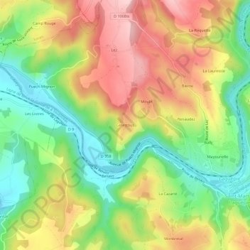
Name: Ginestous topographic map, elevation, terrain.
Average elevation: 241 m
Minimum elevation: 137 m
Maximum elevation: 360 m
Other topographic maps
Click on a map to view its topography, its elevation and its terrain.
Mayounelle
France > Occitanie > Tarn-et-Garonne > Laguépie
Mayounelle, Laguépie, Montauban, Tarn-et-Garonne, Occitanie, France métropolitaine, 82250, France
Average elevation: 256 m