
Konkordiahütte topographic map
Interactive map
Click on the map to display elevation.
About this map
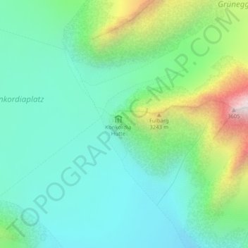
Name: Konkordiahütte topographic map, elevation, terrain.
Location: Konkordiahütte, Fieschertal, Goms, Wallis, Schweiz (46.48988 8.04418 46.50988 8.06418)
Average elevation: 2,839 m
Minimum elevation: 2,545 m
Maximum elevation: 3,654 m
Other topographic maps
Click on a map to view its topography, its elevation and its terrain.
Grosser Aletschgletscher
Schweiz > Wallis > Goms > Fieschertal
Grosser Aletschgletscher, Fieschertal, Goms, Wallis, Schweiz
Average elevation: 2,532 m
Mönch
Schweiz > Wallis > Goms > Fieschertal
Mönch, Fieschertal, Goms, Verwaltungsregion Oberland, Wallis, 3801, Schweiz
Average elevation: 3,392 m
Kranzberg
Schweiz > Wallis > Goms > Fieschertal
Kranzberg, Fieschertal, Goms, Wallis, 3801, Schweiz
Average elevation: 3,403 m
Finsteraarhorn
Schweiz > Wallis > Goms > Fieschertal
Finsteraarhorn, Fieschertal, Goms, Wallis, Schweiz
Average elevation: 3,420 m