Geolocate

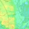
Hoitlingen topographic map

Click on the map to display elevation.

About this map

Name: Hoitlingen topographic map, elevation, terrain.

Location: Hoitlingen, Tiddische, Samtgemeinde Brome, Landkreis Gifhorn, Niedersachsen, 38473, Deutschland (52.47630 10.78148 52.51308 10.92726)

Average elevation: 69 m

Minimum elevation: 54 m

Maximum elevation: 103 m

Other topographic maps

Click on a map to view its topography, its elevation and its terrain.
Gamsen

Deutschland > Niedersachsen > Landkreis Gifhorn > Gifhorn

Average elevation: 60 m

Gear up for your next adventure:

🔪Outdoor Multi-Tools - Versatile tools for gear repairs and food prep in the wild
🎒Hiking Daypacks (20L) - Compact backpacks for day trips and technical mountain ascents
🍳Camping Stoves - Compact stoves for outdoor cooking
🔦LED Camping Lanterns - Illumination for reading maps inside your tent at night
📷Camera Straps - Secure straps for carrying cameras while walking

As an Amazon Associate, this site earns from qualifying purchases at no extra cost to you.