Geolocate

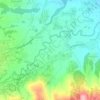
Cihaurkuning topographic map

Click on the map to display elevation.

About this map

Name: Cihaurkuning topographic map, elevation, terrain.

Location: Cihaurkuning, Cisompet, Garut, West Java, 44174, Indonesia (-7.60539 107.79938 -7.55717 107.84433)

Average elevation: 409 m

Minimum elevation: 102 m

Maximum elevation: 695 m

Other topographic maps

Click on a map to view its topography, its elevation and its terrain.
Gunung Sagara

Indonesia > West Java > Garut

Average elevation: 1,784 m

sungai cimanuk

Indonesia > West Java > Garut

Average elevation: 955 m

sungai cimanuk

Indonesia > West Java > Garut

Average elevation: 955 m

Gear up for your next adventure:

🌄Outdoor Binoculars - Compact binoculars for landscape observation
🧭Orienteering Compasses - Accurate compasses for map-based navigation
🛰️Outdoor GPS Navigation - Navigation devices for remote and off-grid areas
🐕Dog Hiking Gear - Equipment for hiking safely with dogs
📍Handheld GPS Navigators - Reliable satellite navigation for hiking and off-road exploration

As an Amazon Associate, this site earns from qualifying purchases at no extra cost to you.