
Ban Thap Wang topographic map
Interactive map
Click on the map to display elevation.
About this map
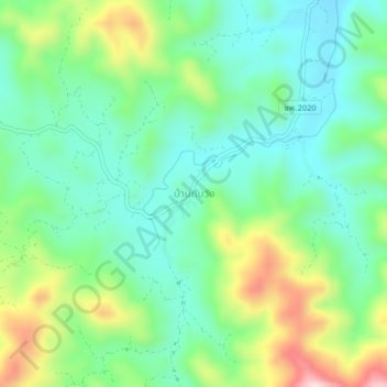
Name: Ban Thap Wang topographic map, elevation, terrain.
Location: Ban Thap Wang, Tha Maphla, Chumphon Province, Thailand (9.82498 98.96453 9.86498 99.00453)
Average elevation: 153 m
Minimum elevation: 46 m
Maximum elevation: 391 m
Other topographic maps
Click on a map to view its topography, its elevation and its terrain.