
Simplon topographic map
Interactive map
Click on the map to display elevation.
About this map
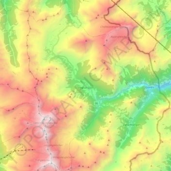
Name: Simplon topographic map, elevation, terrain.
Location: Simplon, Brig, Wallis, 3907, Schweiz (46.12049 7.97968 46.27429 8.11551)
Average elevation: 2,314 m
Minimum elevation: 766 m
Maximum elevation: 4,009 m
Gemäss amtlichem Ortschaftenverzeichnis gliedert sich die Gemeinde Simplon in die Ortschaften Simplon Dorf, Simplon Hospiz und Gabi (Simplon). Historisch gliedert sich die Gemeinde in die Fraktionen Simplon-Dorf, Egga, Gabi und Simplon-Pass. Die Ortschaft Simplon Dorf liegt neun Strassenkilometer südlich der Passhöhe, die ebenfalls zum Gemeindegebiet gehört.
Other topographic maps
Click on a map to view its topography, its elevation and its terrain.