Geolocate

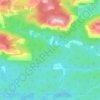
Bell Lake topographic map

Click on the map to display elevation.

About this map

Name: Bell Lake topographic map, elevation, terrain.

Location: Bell Lake, Killarney, Sudbury District, Northeastern Ontario, Ontario, Canada (46.12115 -81.24803 46.16263 -81.17568)

Average elevation: 237 m

Minimum elevation: 204 m

Maximum elevation: 281 m

Other topographic maps

Click on a map to view its topography, its elevation and its terrain.
Eagles Nest

Canada > Ontario > Sudbury District > Killarney

Average elevation: 191 m

Anchor Island

Canada > Ontario > Sudbury District > Killarney

Average elevation: 203 m

Gear up for your next adventure:

🧰First Aid Kits - Essential safety kits for outdoor activities
🧼Biodegradable Soap - Leave-no-trace hygiene for multi-day mountain treks
🧊Personal Water Filters - Drink safely from mountain streams marked on your map
🧤Hiking Gloves - Warm and durable gloves for cold-weather walks
🧴Tick Removal Tools - Small, essential health tool for UK woodland and moorland

As an Amazon Associate, this site earns from qualifying purchases at no extra cost to you.