Geolocate

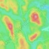
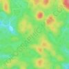
Val-Paquin topographic map

Click on the map to display elevation.

About this map

Name: Val-Paquin topographic map, elevation, terrain.

Location: Val-Paquin, Val-des-Monts, Les Collines-de-l'Outaouais, Outaouais, Quebec, J8N 2H7, Canada (45.73382 -75.72502 45.75382 -75.70502)

Average elevation: 218 m

Minimum elevation: 164 m

Maximum elevation: 346 m

Other topographic maps

Click on a map to view its topography, its elevation and its terrain.
Gear up for your next adventure:

🪓Outdoor Multitools - Versatile tools for hiking and camping
🥫Expedition Meals - Lightweight, high-calorie nutrition for long-distance hikers
🧺Ultralight Dry Bags - Organize and waterproof your gear inside your rucksack
🎿Telescopic Trekking Poles - Reduces knee strain on steep topographic descents
🧣Neck Gaiters - Protects against wind and sun on exposed ridges and peaks

As an Amazon Associate, this site earns from qualifying purchases at no extra cost to you.