Geolocate

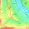
Elze topographic map

Click on the map to display elevation.

About this map

Name: Elze topographic map, elevation, terrain.

Location: Elze, Landkreis Hildesheim, Lower Saxony, 31008, Germany (52.06617 9.62811 52.16920 9.76282)

Average elevation: 104 m

Minimum elevation: 68 m

Maximum elevation: 362 m

Other topographic maps

Click on a map to view its topography, its elevation and its terrain.

Söhre

Germany > Lower Saxony > Landkreis Hildesheim

Average elevation: 139 m

Barienrode

Germany > Lower Saxony > Landkreis Hildesheim

Average elevation: 111 m

Mehle

Germany > Lower Saxony > Landkreis Hildesheim > Elze

Average elevation: 109 m

Gear up for your next adventure:

🧭GPS Trackers - Tracking devices for safety and navigation
🧘Folding Sit Mats - Dry and warm seat for map-reading breaks on damp ground
🧺Ultralight Dry Bags - Organize and waterproof your gear inside your rucksack
🧢Thermal Beanie Hats - Prevent heat loss from the head in windy summit conditions
🧦Hiking Socks - Breathable socks designed to prevent blisters on long walks

As an Amazon Associate, this site earns from qualifying purchases at no extra cost to you.