
Achim topographic map
Interactive map
Click on the map to display elevation.
About this map
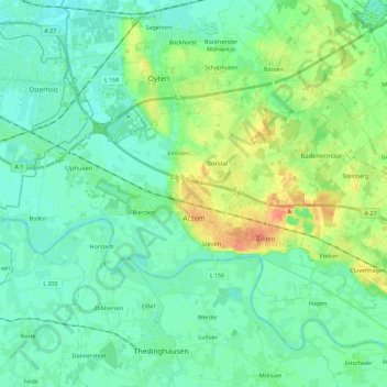
Name: Achim topographic map, elevation, terrain.
Location: Achim, Landkreis Verden, Nedersaksen, 28832, Duitsland (52.98001 8.91583 53.05663 9.14468)
Average elevation: 13 m
Minimum elevation: 2 m
Maximum elevation: 41 m
Other topographic maps
Click on a map to view its topography, its elevation and its terrain.
Landkreis Verden
Duitsland > Nedersaksen > Landkreis Verden
Landkreis Verden, Nedersaksen, Duitsland
Average elevation: 25 m