
Thank you for supporting this site ❤️
Make a donation
Make a donation
Gear up for your next adventure:
As an Amazon Associate, this site earns from qualifying purchases at no extra cost to you.
Epinel topographic map
Click on the map to display elevation.
Thank you for supporting this site ❤️
Make a donation
Make a donation
Gear up for your next adventure:
As an Amazon Associate, this site earns from qualifying purchases at no extra cost to you.
About this map
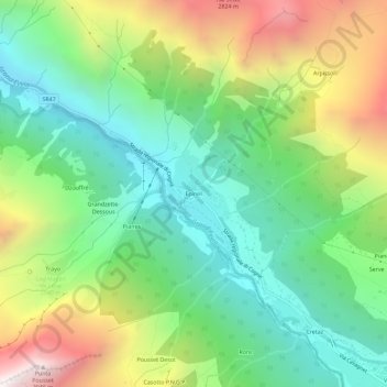
Name: Epinel topographic map, elevation, terrain.
Location: Epinel, Cogne, Aosta Valley, 11012, Italy (45.60908 7.30473 45.64908 7.34473)
Average elevation: 1,950 m
Minimum elevation: 1,336 m
Maximum elevation: 3,051 m
Thank you for supporting this site ❤️
Make a donation
Make a donation
Gear up for your next adventure:
As an Amazon Associate, this site earns from qualifying purchases at no extra cost to you.