
Nguruweni topographic map
Interactive map
Click on the map to display elevation.
About this map
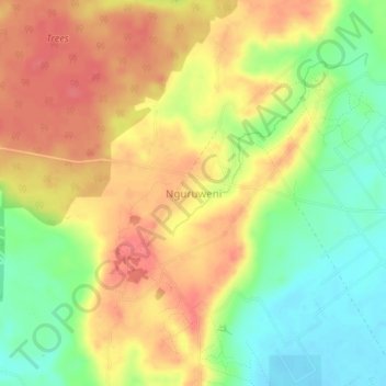
Name: Nguruweni topographic map, elevation, terrain.
Location: Nguruweni, Kwale, Coastal Kenya, Kenya (-4.48660 39.39660 -4.44660 39.43660)
Average elevation: 56 m
Minimum elevation: 20 m
Maximum elevation: 86 m