
Daliguzor topographic map
Interactive map
Click on the map to display elevation.
About this map
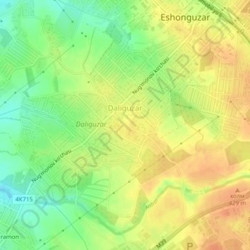
Name: Daliguzor topographic map, elevation, terrain.
Location: Daliguzor, Zangiota Tumani, Tashkent Region, Uzbekistan (41.23147 69.12909 41.25301 69.15148)
Average elevation: 409 m
Minimum elevation: 387 m
Maximum elevation: 424 m
Other topographic maps
Click on a map to view its topography, its elevation and its terrain.
Nazarbek
Uzbekistan > Tashkent Region > Zangiota Tumani
Nazarbek, Zangiota Tumani, Tashkent Region, 111812, Uzbekistan
Average elevation: 411 m