
Lac de Serre-Ponçon topographic map
Interactive map
Click on the map to display elevation.
About this map
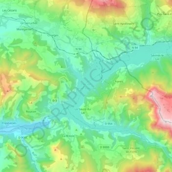
Name: Lac de Serre-Ponçon topographic map, elevation, terrain.
Average elevation: 1,088 m
Minimum elevation: 639 m
Maximum elevation: 2,361 m
Am nördlichen Ufer, in der Nähe des Campingplatzes Roustou, steht auf einer kleinen Anhöhe die Kapelle Saint-Michel. Ursprünglich sollte sie im Zuge des Staudammbaus abgerissen werden, was aber unterblieb, da sie über dem maximal zu erwartenden Wasserpegel steht. Bei niedrigem Wasserstand ist sie vom Ufer aus zu Fuß erreichbar, bei hohem Wasserstand bildet die Anhöhe eine kleine Insel im See.