
Lain topographic map
Interactive map
Click on the map to display elevation.
About this map
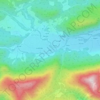
Name: Lain topographic map, elevation, terrain.
Average elevation: 952 m
Minimum elevation: 737 m
Maximum elevation: 1,488 m
Other topographic maps
Click on a map to view its topography, its elevation and its terrain.
Rainer
Germany > Bavaria > Landkreis Bad Tölz-Wolfratshausen > Jachenau
Rainer, Jachenau, Landkreis Bad Tölz-Wolfratshausen, Bavaria, 83676, Germany
Average elevation: 925 m