
Fraineux topographic map
Interactive map
Click on the map to display elevation.
About this map
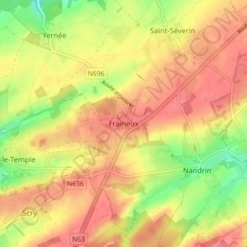
Name: Fraineux topographic map, elevation, terrain.
Location: Fraineux, Nandrin, Huy, Lüttich, Wallonien, 4550, Belgien (50.49390 5.38063 50.53390 5.42063)
Average elevation: 245 m
Minimum elevation: 200 m
Maximum elevation: 273 m
Other topographic maps
Click on a map to view its topography, its elevation and its terrain.