Geolocate

Labney topographic map

Click on the map to display elevation.

About this map

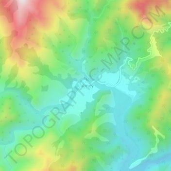
Name: Labney topographic map, elevation, terrain.

Location: Labney, Mayantoc, Tarlac, Central Luzon, 2304, Philippines (15.54352 120.27170 15.58352 120.31170)

Average elevation: 379 m

Minimum elevation: 155 m

Maximum elevation: 820 m

Other topographic maps

Click on a map to view its topography, its elevation and its terrain.

Mamonit

Philippines > Tarlac > Mayantoc

Average elevation: 71 m

Gear up for your next adventure:

👟Heavy Duty Boot Laces - Always carry a spare for your hiking footwear
🧼Biodegradable Soap - Leave-no-trace hygiene for multi-day mountain treks
🥾Hiking Boots - Waterproof and durable boots for long-distance hiking in the UK
🥫Expedition Meals - Lightweight, high-calorie nutrition for long-distance hikers
🪓Outdoor Multitools - Versatile tools for hiking and camping

As an Amazon Associate, this site earns from qualifying purchases at no extra cost to you.