
Tecopa topographic map
Click on the map to display elevation.
Tecopa
Tecopa (formerly Brownsville[4]) is a census-designated place (CDP) in the Mojave Desert, in Inyo County, California, United States. Tecopa is located 9 miles (14 km) south-southeast of Shoshone,[4] at an elevation of 1,339 feet (408 m).[3] The population was 150 at the 2010 census, up from 99 at the 2000 census.
About this map
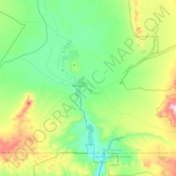
Name: Tecopa topographic map, elevation, terrain.
Location: Tecopa, Inyo County, California, United States (35.79330 -116.28677 35.89955 -116.10947)
Average elevation: 508 m
Minimum elevation: 308 m
Maximum elevation: 926 m
Other topographic maps
Click on a map to view its topography, its elevation and its terrain.