
Thank you for supporting this site ❤️
Make a donation
Make a donation
Gear up for your next adventure:
As an Amazon Associate, this site earns from qualifying purchases at no extra cost to you.
Mouchak topographic map
Click on the map to display elevation.
Thank you for supporting this site ❤️
Make a donation
Make a donation
Gear up for your next adventure:
As an Amazon Associate, this site earns from qualifying purchases at no extra cost to you.
About this map
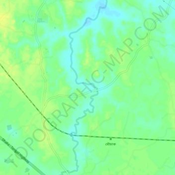
Name: Mouchak topographic map, elevation, terrain.
Location: Mouchak, Gazipur District, Dhaka Division, 1751, Bangladesh (24.03034 90.25659 24.07034 90.29659)
Average elevation: 12 m
Minimum elevation: 3 m
Maximum elevation: 20 m
Thank you for supporting this site ❤️
Make a donation
Make a donation
Gear up for your next adventure:
As an Amazon Associate, this site earns from qualifying purchases at no extra cost to you.