Geolocate

Kangding topographic map

Click on the map to display elevation.

About this map
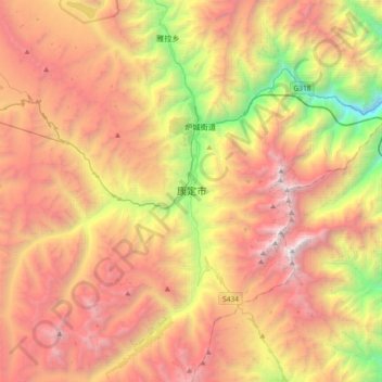
Name: Kangding topographic map, elevation, terrain.

Location: Kangding, Kangding City, Sichuan, 626000, China (29.84142 101.79482 30.16142 102.11482)

Average elevation: 3,942 m

Minimum elevation: 1,730 m

Maximum elevation: 6,018 m

Other topographic maps

Click on a map to view its topography, its elevation and its terrain.
贡巴冰川

China > Sichuan > Kangding

Average elevation: 5,375 m

康定跑马山风景区

China > Sichuan > Kangding > Jingangsi

Average elevation: 2,804 m

Gear up for your next adventure:

🧼Camping Hygiene Kits - Compact hygiene essentials for outdoor stays
🍱Food Containers - Reusable containers for outdoor meals
🧢Thermal Beanie Hats - Prevent heat loss from the head in windy summit conditions
🥾Women's Waterproof Hiking Boots - High-performance trekking boots designed for all-weather comfort
🍲Portable Camping Stoves - Fast-boiling stoves for hot meals on remote topographic survey trips

As an Amazon Associate, this site earns from qualifying purchases at no extra cost to you.