
Thank you for supporting this site ❤️
Make a donation
Make a donation
Gear up for your next adventure:
As an Amazon Associate, this site earns from qualifying purchases at no extra cost to you.
Kakkanad topographic map
Click on the map to display elevation.
Thank you for supporting this site ❤️
Make a donation
Make a donation
Gear up for your next adventure:
As an Amazon Associate, this site earns from qualifying purchases at no extra cost to you.
About this map
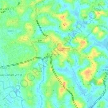
Name: Kakkanad topographic map, elevation, terrain.
Location: Kakkanad, Kanayannur, Ernakulam district, Kerala, 682030, India (9.99657 76.32275 10.03657 76.36275)
Average elevation: 13 m
Minimum elevation: -4 m
Maximum elevation: 35 m
Thank you for supporting this site ❤️
Make a donation
Make a donation
Gear up for your next adventure:
As an Amazon Associate, this site earns from qualifying purchases at no extra cost to you.